
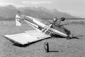
do's and don'ts of mountain flying
 DON’T fly into unimproved mountain strips without a minimum of
150-hours total flight experience. Even then, be proficient at slow flight
manoeuvring and the spot method for landing.
DON’T fly into unimproved mountain strips without a minimum of
150-hours total flight experience. Even then, be proficient at slow flight
manoeuvring and the spot method for landing.
DON’T plan a cross-country flight into the mountains when the
wind at mountaintop level exceeds 30 knots unless you are experienced in this
type operation (strong updrafts, strong downdrafts and moderate or greater
turbulence). This does not preclude taking a “look-see.” Often with a stable
air mass the air will contain very little turbulence during these high-wind
conditions. Expect the wind velocity to double or more in mountain passes and
over the ridges due to a venturi effect.
DON’T choose a route that would prevent a
suitable forced-landing area.
DON’T
leave the airplane without a compelling reason if you have executed an
emergency or precautionary landing. Temporary evacuation may be
necessary if a fire hazard exists.
DON’T go if the weather is doubtful or “bad.”
DON’T become quiescent with weather reports of
ceilings of 1,000-2,000 feet. The ceiling is reported above ground
level. Often, in the mountains, the weather reporting facility will
be surrounded by mountains that extend thousands of feet higher than
the facility. Clouds may obscure the mountains and passes in the
vicinity.
DON’T fly VFR or IFR in the mountains in an
unfamiliar airplane make and model. It is required that you learn
the flight characteristics, slow flight and stalls in various
configurations, beforehand.
DON’T make the landing approach too slow. Some pilots
feel they have to make a low approach on the backside of the power
curve to get into a mountain strip. This “hanging on the prop” is a
dangerous operation. Use a stabilized approach for all landings.
DON’T operate low-performance aircraft into marginal
mountain strips. If in doubt about your takeoff, use the “sufficient
runway length” rule of thumb.
DON’T rely on cloud shadows for wind direction
(unless you are flying at or near the cloud bases). Expect the wind
to be constantly changing in direction and velocity because of
modification by mountain ridges and canyons.
DON’T fly close to rough terrain or cliffs when the
wind approaches 20 knots or more. Dangerous turbulence may be
encountered.
DON’T
fail to realize that air, although invisible, acts like water
and it will “flow” along the contour of the mountains and valleys.
Visualize where the wind is from and ask yourself, “What would water
do in this same situation?”
DON’T
slow down in a downdraft. By maintaining your speed, you will
be under the influence of the downdraft for a lesser period of time
and lose less altitude overall.
DON’T
forget or fail to realize the adverse effect of frost. Less
than 1/8 inch of frost may increase the takeoff distance by 50
percent and reduce the cruise speed by 10 percent. Often, if the
airplane becomes airborne, the smooth flow of air over the wings is
broken up by the frost and the extra drag prevents the airplane from
climbing out of ground effect.
DON’T give insufficient attention to the importance
of fuel and survival equipment. It is important to keep the airplane
light, but don’t skimp on these items.
DON’T
fly the middle of a canyon. This places you in a poor
position to make a turnaround and it subjects you to shear
turbulence.
DON’T
fail to use the same indicated airspeed at high-altitude
airports that you use at low-altitude or sea level airports for the
takeoff or for the approach to landing.
DON’T
be too proud or too vain to check with experienced mountain
pilots concerning operations to and from unfamiliar fields.
DON’T attempt VFR flight in mountainous terrain
unless you have the minimum visibility you have established as a
personal safety standard.
DON’T become complacent about the horizon when flying
with outside visual reference. A gentle upslope terrain may cause an
unknown constant climb with the possibility of an inadvertent stall.
The horizon is the base of the mountains some six to eight miles
away.
DO file a flight plan for each leg of your flight.
Also, make regular position reports to allow search and rescue
personnel to narrow down the search area if you are overdue on the
flight plan.
DO familiarize yourself with the high-altitude
characteristics and performance of your airplane. This includes the
takeoff and landing distance and rate of climb under various density
altitude conditions.
DO spend some time studying the charts to determine
the lowest terrain along the proposed route of flight. If possible,
route the flight along airways.
DO have confidence in the magnetic compass. The
compass (unless it has leaked fluid or someone has placed
interfering metal near its magnets) is the most reliable instrument.
Charts will show the areas of local magnetic disturbance that may
affect the accuracy of the compass reading.
DO
plan the fuel load to allow flight from the departure to the
destination airport with a reserve to counter unexpected winds.
DO fly a downdraft, that is, maintain speed by
lowering the nose of the airplane. Unless the airplane is over a
tall stand of trees or near a shear cliff, the downdraft will not
extend to the ground (exception: microburst).
DO use Sectional Aeronautical Charts instead of World
Aeronautical Charts (WAC) because of the greater detail (8 miles per
inch).
DO
approach ridges at an angle. The recommendation is to use a
45-degree angle approach when in a position of one-half to
one-quarter mile away. This allows an escape, with less stress on
the pilot and airplane, if unexpected downdrafts or turbulence are
encountered. Flying perpendicular to the ridge, rather than at a
45-degree angle, does not mean you cannot escape the downdraft or
turbulence by making a 180-degree turn. But, it does mean the
airplane will be subjected to the effects of the downdraft and
turbulence for a greater period of time. Usually, a steeper bank
will be required to make the 180-degree turn. This will increase the
g-loading stress on the airplane.
DO use common sense when performing takeoffs or
landings at mountain strips. If you have any doubt about the
operation, confirm the aircraft performance using the Pilot’s
Operating Handbook or Owner’s Manual. If the physical conditions are
adverse and compromise the operation, delay the operation until
conditions are better.
DO count on the valley breeze (wind blowing upstream
during the morning hours) and the mountain breeze (wind blowing
downstream during the evening hours). In an otherwise calm wind
condition the valley breeze will create an approximate 4-knot
tailwind for landing upstream. The mountain breeze will cause an
approximate 8-knot to 12-knot tailwind for takeoff downstream.
DO make a stabilized approach for landings. Since the
late ‘60s the power-off approach has been discouraged because of
thermal shock to the engine.
DO
remember your study of aerodynamics. It is possible to stall the
airplane at any airspeed and any attitude (providing you are strong
enough and the airplane doesn’t break first). If a stall is entered
in the same manner, for example, with a slow deterioration of the
airspeed, it will stall at the same indicated airspeed at all
altitudes.
|
