It is essential that a pilot check the density
altitude.
It is essential that a pilot check the density
altitude.
Before any flight check runway lengths at airports
of intended use, and takeoff and landing distance information ... also ensure
that the aircraft will be able to perform with an adequate safety margin under
the expected values of airport elevation and runway slope, aircraft gross
weight, and wind and temperature.
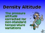
Density altitude is a term that sometimes causes
confusion. A high density altitude is NOT a good thing. Density
altitude is defined as the pressure altitude corrected for
non-standard temperature variations. And while this is a correct
definition, my definition is perhaps more appropriate: DENSITY
ALTITUDE IS THE ALTITUDE THE AIRPLANE THINKS IT IS AT, AND PERFORMS
IN ACCORDANCE WITH.
Density altitude can be computed on a density
altitude chart, flight computer, electronic flight calculator or by
rule of thumb. Density altitude gives us some idea about the
expected performance of the airplane, but only if you apply the
information to the performance charts.
An accurate rule of thumb
(usually any error will be less than 300 feet) for determining the
density altitude is easy to remember. For each 10-degrees Fahrenheit
above standard temperature at any particular elevation, add 600 feet
to the field elevation. (And, conversely for each 10-degrees F below
standard temperature, subtract 600 feet.)
Standard temperature at sea
level is 59-degree Fahrenheit. For elevations above sea level,
subtract 3.5 degrees per thousand feet of elevation from the sea
level temperature of 59 degrees. For example, at Jackson, Wyoming
the elevation is 6,444. Multiply 6.444 times 3.5 for 22.55. Subtract
this from 59 (59-22.55) for 36.45. The standard temperature at
Jackson is 36.5 degrees. If the existing temperature is 80 degrees,
subtract (80-36.5 = 43.5). Divide this difference by 10 degrees (for
each 10-degrees F above standard), and multiply 4.35 times 600 (600
feet per 10 degrees) equals 2,610. Add 2,610 to the field elevation
(6,444) for a density altitude of 9,054. Under the existing
conditions (of our example), the airplane will perform as it would
on a standard day at 9,054 feet
elevation.
Density altitude not only affects the takeoff
distance and rate of climb, but also applies to the service ceiling
of the airplane while en
route.
A simple rule of thumb for determining takeoff
distance exists that helps you deal with density altitude during
takeoff. The only problem is that it does not guarantee rate of
climb after takeoff, but it insures that you will be able to takeoff
in the distance available for the runway involved.